Twitter

Wednesday, November 23, 2011

The Not So Concerned Citizens

Within Baltimore's Foest Park Area there are several smaller Neighborhoods that make up the area as a whole including; Forest Park, West Forest Park, Central Forest Park, The Concerned Citizens of Forest Park, and Forest Park Golf Course. Put them together and you'll have the "Greater Forest Park Area" most of these Neighborhoods are some of the finest Baltimore has to offer containing an African American Middle and Upper Class Residents, consisting of mostly large Single Family Homes that have been gorgeously restored over the years as well as smaller Single Family Homes, Duplexes, Row Homes, and Apartments. Most of the Greater Forest Park Area has avoided urban decay with only a few vacants to speak. However there is one Neighborhood in the Forest Park Area that hasn't escaped Urban Decay and its housing stock has become distressed.
Ironically of the Neighborhoods consisting of Forest Park, the one whose name suggests it to be the most stable, that very Neighborhood is the most distrsessed. I'm speaking of course about the Concerned Citizens of Forest Park (CCOFP). CCOFP south of Forest Park Avenue, north of Wayne Avenue, East of Lyndhurst Avenue, and west of Garrison Boulevard.
This Neighborhood, unlike the rest of Forest Park is almost all Row Homes with a few Single Family Homes mixed in. My educated guess is that some of the Single Family Homes were once sprawling Estates that were subdivided into Row Homes that now make up CCOFP. The Single
Family Homes for the most part appear older and distressed.
CCOFP's state aside, Forest Park packs a lot of punch in its name. It is very easy to look past the lack luster Retail selection and see the character of the homes, the relatively low crime, and the many parks in the area such as Leakin Park, Lake Ashburton, and Forest Park Golf Course. It's easy to see why Forest Park acts as a destination and how the name speaks of an affluent area.
So how did CCOFP get this way? Could it be that it's primarily Row Homes and not Single Family Homes? My theory is that it's BECAUSE Forest Park thought of as an enclave for the Middle Class and Upper Middle Class that the condition of CCOFP has remained under the radar.
It's hard to imagine that Forest Park or anything tied to its name could have ditsressed housing stock or a high vacancy rate. I wasn't aware of it myself until I spent some time there delivering
literature on foot. I was honestly shocked but it gave me the idea for this post so it can't be all bad.
Forest Park, being in the position that its name sells, would bode quite well to newly redeveloped housing stock selling well. CCOFP is in a state where I feel redevelopment is the only option. I also think it well speak well to the area having some new housing stock added to it. Now what par of CCOFP would I slate for redevelopment? All of it. Yes all of it, the Neighborhood is small enough that it could be amcomplished relatively easily. It also has a low home ownership rate
as compared to Neighboring Areas.Now what type of new housing stock will replace the aged housing stock in CCOFP? New Town Homes. They will be large in size complete with a two car garage in the rear that will go along with Baltimore's "classic row house alley." Town Homes will be featured in the new CCOFP except along Garrison Boulevard where Apartments like the new Senior Apartment Building will be built.
I know that the redevelopment of an entire Neighborhood seems like a drastic step but condsiering how small said Neighborhood is and how it stem the tide if urban decay that may easily plague the rest of Forest Park if intervention isn't done in CCOFP. I mentioned how unlike the rest of the Neighborhood that Garrison Boulevard will have Apartments on its frontage. Perhaps this opening a door to a future post?

Tuesday, November 22, 2011

Adios Armistead

The first post I did regarding Armistead Gardens I posed the question of whether the "experiment" of turning a public housing project like McCulloh Homes into the hands of its tenants by making it a Co-Op. Since then, my opinion has shifted away from a Co-Op at McCulloh towards a redevelpment of the site, mostly due to the fact that I learned that Uplands had been a CoOp.
That post landed a lot of comments from Residents of Armistead Gardens both past and present blasting the Co-Op and the Neighborhood in general. Comments saying that the Co-Op is racist or fines Residents for not making repairs they can't afford or that the Nieghborhood has
become an open air drug market and that Kids who have grown up there become addicts and that those currently living there want nothing more than to get out.
This unprecedented amount of responses led me to write another post regarding Armistead Gardens entitled; Should Armistead Gardens Hit the Wrecking Ball? Obviously, this post gave a less favorable synopsis of Armistead Gardens which was merely echoing the sentiment of user
comments from my original post. The title question was never answered because I left it open to discussion for people to comment on. My plan to have additional reader comments worked perfectly. There were a lot of comments regarding Armistead Gardens in a less than favorable tone from its Residents. In not so many words they said Yes Armistead Gardens Should Hit the Wrecking Ball so here I am in November 2011 saying "Adios Armistead!"
Originally Armistead Gardens was a product of World War II. It was Barricks for the now defunct Fort Armistead. After World War II Armistead Gardens, like other Barrick housing development such as O'Donnell Heights and Cherry Hill, it was converted to Public Housing.
Unlike the other aforementioned developments, Baltimore wanted to get rid of Armistead Gardens from their Public Housing Portfolio in 1955. It was then that the City turned Armistead over to its Residents who in turn formed a Co-Op in which Residents owned their homes but were automatically subject to a 99 year ground lease.
Armistead then became a very tight market. There are some homes that have never been bought or sold since 1955, they've just "stayed in the family" for generations. There has been very little influx in 20th century Armistead Gardens. Between 2000 and 2010 there has been more influx than in previous decades the almost all White Armistead has seen a rapid increase in Hispanic Residents in the past 10 years.
There are several theories as to why Armistead Gardens has gone down hill, one is that there is a lack of influx, another is that the Hispanic Influx has had a negative effect, another is that the tear down of Neighboring Public Housing developments Freedom Village, Claremont Homes, and Hollander Ridge have had a "spillover" of their crimes into Armistead. Whatever the cuase may be for the decline of Armistead, it appears as far as my readers are concerned, that redevelopment might be the only choice.
One big reason I'm choosing Armistead as a potential redevelopment site is its lcoation. I forsee the far east side if Baltimore from Herring Run Park to Hopkins Bayview being transformed into a TOD haven. My reason? The Red Line and the East Baltimore MARC Station that comes with it. The Bayview stop on the Red Line is the proposed location of the East Baltimore MARC. One thing that's misleading is that the "Bayview" stop is actually located in Orangeville just north
of Bayview.
Orangeville, for the most part is a 20th Century Industrial Park with varying degress of occupied land. There are also a few houses in a very small residential enclave. There is plenty of vacant land in Orangeville that could be rezoned into mixed use high density residential with ground floor retail with improved "Office Flex Space" and an Indutrial Overlay so as not to kick out remaining Industry.Orangeville, in addition to being located directly north of Bayview, it is also directly south of Armistead Gardens. Armistead Gardens would be just included as part of the Orangeville Redevelopment.
I always envisoined a redeveloped Armistead as a higher density alternative to Orchard Ridge which has replaced the Freedom Village and Claremont Homes Pubic Housing Projects. The densities would be exchanged from the original land uses seeing as Armistead is low density and Freedom Village and Claremont Homes were High Density that have since been redeveloped as the low density Orachrd Ridge. It only seems fitting that a redeveloped Armistead be high density. The Orangeville Armistead area is poised for big change thanks to the Red Line and East Baltimore MARC Station.
Seeing as Armistead Residents have shown very little Neighborhood Pride and sentmenality please join them and myself when we say; Adios Armistead!

Tuesday, November 15, 2011

Liberty Height Redevlopment III Mondawmin College Town

It would make sense that the final installment of my series of Liberty Heights Redevelopment be focused on the eastern terminus of Liberty Heights; Mondawmin Mall. Mondawmin Mall has improved itself leaps and bounds over the past several years thanks to a $60 Million renovation
and new anchor tenants like Target, Shoppers Food Warehouse, Marshalls, and Ana's Linens. Yes Mondawmin Mall is a great suburban destination. The only probem with that statement is tat Mondawmin Mall is located in the City where in order to stay viable, high density and walkability reign king. To ensure continued success at Mondawmin Mall and surrounding areas; further redevelopment and other changes should be made.
The Mondawmin area, in my opinion is something of an untapped resource. It can be something of a College town like Mount Vernon and Charles Village. Mondawmin's location near both Baltimore City Community College and Coppin State University. Both Schools have grown
tremendously over the past decade and Mondawmin Mall can be the perfect Retail and Transit Haven for both Schools.Although the Mall is currently one of Baltimore's busiest Rail Transit Hubs; it's not nearly what it could be. One reason is that the entire Mondawmin Area and all that surround it are not considered to be the same area. Druid Hill Park, Coppin State University, Baltimore City Community College and Lake Ashburton are not recognized as Neighbors.
A good way to unify the area is way finding signs. These will alert people as to where they are in relation to other Community Amenities and if the designs to the signs are unique to the Mondawmin area, that will further unify the area. Another way would to expand the underground area of the Metro Station. This will be very costly but I do see it fitting. If escalators were located not just at the Mall entrance facing Liberty Heights, but also at Druid Hill Park, Baltimore City Community College, and Coppin State University. The additional entrances and exits will allow for a larger ridership base for the Metro where said riders might not have considered it in the past.
On the Retail end, Mondawmin's current selection is serving the Population quite well and I foresee it continuing to do so for years to come. One thing that can be brought to the area that it is currently lacking is Transit Oriented Development (TOD) If you read my much older post Mondawmin Mall Stuck in the Suburbs you will probably know where this is going. If you didn't or you've forgotten, I'll write it again. If there's one thing I don't like in an urban area
it's surface level parking. I think it is a waste of valuable space and in an urban area it shows little to no value in the land. If surface level parking exists it means that no other developers,
retailers, or businesses are interested in coming to the area. In other words, if there was demand to build in the area, the surface parking lots would be long gone.Now how do we create that demand in Mondawmin? Easy all we have to do is emphasize its strategic location on the Metro and its proximity to two Colleges and two parks and the Zoo. The Colleges and the Mall are all major Employers in their rights. So who wouldn't want to live just
steps from the Metro that will take them to Work and who wouldn't want to live near Campus without living directly on it? By planting questions like that in the heads of people looking to move to the City whether it be for Work or School, Mondawmin proves itself a healthy contender. Now there's your demand.
TOD is usually high density in order to force as many units or suites into a small area as possible. Mondawmin Mall's surface lots are obviously my preferred location for TOD in Mondawmin. TOD in the area will be mostly residential in the form of mixed income Apartments,
Condos, and "stacked" Town Homes. A few buildings will be designated as Student Housing for the Neighboring Colleges. Also on property located within the residential buildings will be a Hotel. Now this begs the question; where will people now park? With my proposed expansion of the Metro station into areas other than the Mall, this allow for an underground Parking deck that will encompass the foot print of the current Mall Parking Lot and will serve the Mall and
residences above it.Well that concludes my series of posts regarding the redevelopment of
Liberty Heights Avenue. By focusing on Howard Park, Forest Park, and
Mondawmin, it should create a synergy that will stretch across all of
Liberty Heights.

Saturday, October 22, 2011

Liberty Heights Redevelopment II Forest Park Town Centre

Just a few short blocks east of Howard Park Town Centre lies Forest Park Town Centre. The execution of this plan will be a lot more involved than that of its neighbor to the west. Forest Park Town Centre is located at the poorly planned intersection of Liberty Heights, Berwyn, Forest Park Avenue, and Garrison Boulevard. Along with redevelopment and improvements to buildings, the traffic patterns will be adjusted to ensure a smoother traffic flow.

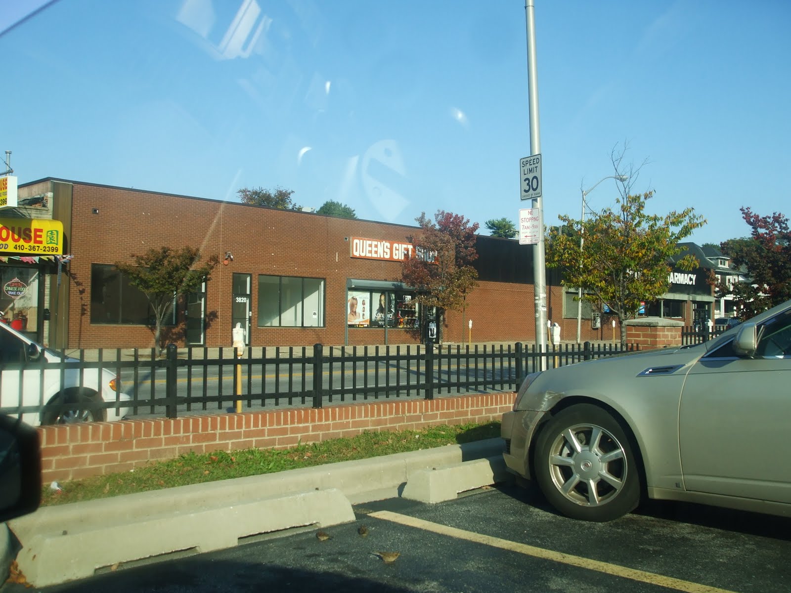
The Retail selection in Forest Park lackluster at best. Then again the adjacent housing stock is distressed at best. This post is not dedicated to the housing stock, it is about the Retail selection and the need for improvement in the blocks surrounding Liberty Heights Avenue and Garrison Boulevard. The residences that are distressed along Liberty Heights however will be discussed.
The only way to make sense out of any redevelopment plan is to look at the roads and see if changes will be made there. In this case, changes will be made to the roads in question so they will be discussed first. Berwyn Avenue will not go below Liberty Heights as it does now. Garrison Boulevard will be the only way to get to Liberty Heights. If travelling north on Garrison all traffic will bare right to stay on Garrison as Berwyn will now be closed. Also Forest Park Avenue will be realigned to make for one intersection at Garrison instead of the two not being even like they are now. By simplifying the traffic pattern in the heart of Forest Park it will flow much more smoothly.
Another casualty of the traffic reconfiguration is Liberty Elementary School. As part of my plan to introduce New School Construction to the City while reducing the surplus of seats will be tear down the current building and rebuild the School (renamed Forest Park Elementary) on Liberty Heights where its current intersection with Berwyn Avenue is. Forest Park Elementary will house the population of Liberty Elementary and two other Neighboring Elementary Schools and will look like the above photo.
Most existing Retail will be torn down as it is dated and blighted. In order to introduce New Retail to Forest Park the buildings that house it must also be new. The new Walgreens is a perfect example of this. In addition to new Retail, there should be apartments located above. New Retail should be include but not be limited to; Starbucks, Bob Evans, Pizzeria Unos, Banks (not check cashing). a Dry Cleaners, Qdoba Mexican Grill, Five Guys, Ritas, and Dollar Tree. In other words convenience Retail. The Rite Aid and GNC will be located in New Buildings.
Also to be included with the residential redevelopment is Liberty Post Apartments and a few stray garden Apartments along Liberty Heights between Howard Park Town Centre and Forest Park Town Centre they will be replaced with more fitting higher density Apartments. If there is a concentration of Single Family Homes along Liberty Heights that have gone vacant, they can also be torn down and redeveloped with a higher density Apartments as well.
Well that concludes my plan the Forest Park Town Centre, keep in mind this is a very focused area this post concentrates on and this isn't all that needs to be done in Forest Park. There will be future posts regarding the Forest Park area as a whole and redevelopment that needs to take place. Stay tuned!

Thursday, October 13, 2011

Liberty Heights Redevelopment I Howard Park Town Centre

For thoroughfares that run through the outskirts of the City, I find it best to think of them as small towns and said thoroughfares as the "Main Street" of those small towns. Enter Liberty Heights Avenue, the perfect example of a Main Street that runs through a cluster of Neighborhoods in Northwest Baltimore in a manor that mimics Suburbia. This is the first in a series of three posts that will tackle Liberty Heights each post dedicated to a little "Town Centre" that will be developed or redeveloped to serve the needs of each Neighborhood Cluster. This particular post is dedicated to Howard Park.
Howard Park, as far as Liberty Heights is concerned is the closest to the City/County Line. Out of the three clusters, Howard Park has the best "bones" to work with, in other words redevelopment here will be minimal. The housing stock in Howard Park is also the most suburban of the three.
The "Howard Park Town Centre" got a shot in the arm when it was announced that at long last the addition of a full service grocer will be opening by 2013 in the form of a Shop Rite. The Shop Rite will be located on the site of the former Howard Park Super Pride at Liberty Heights and Gwynn Oak Avenue which will be torn down to make way for the Shop Rite. Liberty Heights between Gywnn Oak and Hillsdale will be the core of Howard Park Town Centre.
The Shop Rite will definitely be largest Retail Change to the area but there should be another redevelopment project across Hillsdale Road. In my ever lasting crusade to bring new School Construction to Baltimore City, I'm proposing that Calvin M. Rodwell Elementary be torn down and rebuilt with the population of itself and two other neighboring Elementary Schools to cut down on the surplus of capacity City Schools face.
The front of the "new" Calvin M. Rodwell Elementary (which will be renamed Howard Park Elementary) will face Liberty Heights Avenue rather than Hillsdale like it currently does.
Aside from the old Super Pride that's shuttered, perhaps the biggest eye sore in the Howard Park Town Centre is the old Ambassador Theatre. I don't have much knowledge of this once vibrant epicenter of Howard Park but what I do know is that it is currently shuttered and there aren't any plans to revive it. Luckily my plan does include a revived Ambassador. One shortage that's painfully obvious in all of Baltimore is the lack of first run Movie Theatres. One should also note that large Cinema Multiplexes in the Suburbs show the same Movie on Several Screens. This proves that any new Movie Theatre should have fewer screens and maximize profits that way. The Ambassador fits the bill perfectly. Although it's a one screen venue currently, it has a seating capacity of over 1,000. The inside could easily be renovated to make way for five to seven screens each with a seating capacity between 100 and 200 per screen. With a smaller foot print, profits can be maximized without showing the same movie twice while still showing a good number of first run Movies. Whichever Theatre company takes over ownership of the Ambassador must restore the Vertical Marquis of the Ambassador to its former glory.
The last large piece of the Howard Park Town Centre includes what looks like a vacated iHop from the color scheme outside. This will not torn down but it will be backfilled by a Sonic. Judging by the volume of business at the only area sonic in Randallstown, I think this will be a winning venture.
Those are the biggest changes put forth in my Howard Park Town Centre Plan. I think these additions will encourage better Retail options than what is currently there. Additional Banks, Dry Cleaners, a Subway, Starbucks, and Sit Down Restaurants. In addition existing store fronts will be upgraded to include better signage and elimination of metal pull down gates and bars on windows to make for a more pleasing atmosphere.
Well that's my plan for the Howard Park Town Centre, the new Shop Rite makes for an excellent building block to set other things in motion and hopefully such a synergy can be acheived. Stay tuned for future posts regarding Liberty Heights as this is the first in a series.

Thursday, September 22, 2011

Howard Park Super Pride: The End of an Era

On Saturday September 10th, the Howard Park Super Pride Pride Sign came down signaling the end of the Local Chain's tenure in Baltimore. Actually, the store has been closed for 11 years, it's just that it's taken that long to remove the sign. I don't see what the big deal was, it was done in a matter of hours. I just happened to be there at the corner of Liberty Heights and Hillsdale Road as it happened.
The fate of the Super Pride was sealed as "Neighborhood" Supermarkets began to expand to sizes that were up to three times that of the Super Pride. The Supermarket mentality has been go big or go home. I guess Super Pride swallowed its Pride and went home.
Howard Park began as a few estate homes that lined Liberty Heights Avenue at around the turn of the Century. Back then this was still the County. I believe Howard Park was part of the 1918 annex (correct me if I'm wrong). Howard Park acted as a flight to the suburbs before there were real suburbs. Howard Park, to the naked eye looks like a Suburb being that it's located on the extreme outskirts of the City.

Between World War I and the Great Depression Howard Park saw unprecedented growth. The stately Victorians that line Howard Park's Main Streets were joined by small bungalows, duplexes, and a few row homes and Apartments. Liberty Heights Avenue quickly became the Neighborhood's Make shift Main Street. The Retail has always been Liberty Heights and Gwynn Oak and the blocks immediately surrounding the intersection.
The Grocery Store located at the corner of Liberty Heights and Gwynn Oak showed that Howard Park was indeed a suburb. Although located in the City, the Corner Store that to this day so many Baltimorons depend on were absent. Instead what was then a large suburban style Grocery Store was built. As cars became the norm, this new Grocery Store became a magnet for all of Northwest Baltimore.
I couldn't find much information about Super Pride itself so I pieced together what little information I had in hopes that someone who reads this has more info and can fill me in via the comments field. Super Pride was the Grocery Store by the 1970s. The little building that housed the Super Pride has three spaces. Eventually the Super Pride had expanded into all three spaces. This was the beginning of the go big or go home mentality. Business had slowly begun to dwindle as newer and therefore bigger Grocery Stores and Northwest Plaza (Food King) and Reisterstown Road plaza (Giant) had opened.
The Super Pride had become compromised as Convience Stores and large Drug Stores that were almost equal in size begun popping up along Liberty Heights Avenue. Eventually in 2000, the Super Pride shut its doors and pulled down its metal latch for the last time. The once proud suburban Grocery Store that was Super Pride had become a vacant eyesore although the sign remains. At least one interim business took space in the old Super Pride. Around 2008-2009 a Tennis Shoe Warehouse took the space and there are still signs advertising it although the business is shuttered.
Howard Park Residents in the first part of the 21st Century worked tirelessly to get a new Grocery Store and redevelop the site of the old Super Pride. Sadly there were no takers. During the O'Malley years a Strategic Neighborhood Neighborhood Action Plan (SNAP) that includes Howard Park and a redevelopment scenario for the intersection of Liberty Heights and Gwynn Oak that calls for a new Grocery Store and additional Retail Space as well as the demolition of the Super Pride.
Well here we are in late 2011 in the middle of the worst economy since the great depression. Against all odds Howard Park has landed a new Grocery Store. Up & Comer Shop Rite has decided to open up shop at the site of the former Super Pride. The announcement came just three days before the City Primary Elections in a very public spectacle with City Officials including the Mayor. Congressmen Elijah Cummings even showed up and spoke. How do I know? I was there. The highly puclicized event inluded the demolition of the Super Pride sign (that had still been up 11 years after its closure) and the unveiling of the Artist's rendering of the Shop Rite.
The demolition of the old Super Pride sign signaled the end of an era although said era ended in 2000 when the aforementioned store actually closed but with addition of Shop Rite it also signals the beginning of a new one.